Aerial Views
Click on images to view larger sized photos and to purchase prints.
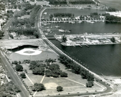
Aerial view of the downtown waterfront and Al Lang Field, looking north toward the Vinoy Hotel, c. 1947.
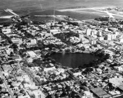
Aerial view looking southeast, c. 1950. Mirror Lake is in the center, with the Million Dollar Pier, Yacht Basin, and Whitted Airport along the shore, left to right.
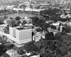
Aerial view of Princess Martha Hotel and Williams Park, c. 1926. Mirror Lake and several schools, including a newly built St. Petersburg High School, are in the background.
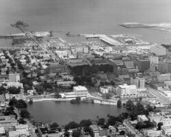
Aeriel view of Mirror Lake, looking east. The newly built Sebring Building and St. Petersburg Judicial Building are along its eastern edge, c. 1973.
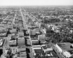
Looking west along Central Ave. from 3rd St, c. 1955. Gas Plant and Webb's City in the upper left. Mirror Lake and Williams Park in the upper right. Atlantic Coast Line along 1st Ave. S.
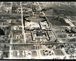
Undated aerial photograph of the St. Petersburg High School campus between 5th Ave N. and 9th Ave. N.
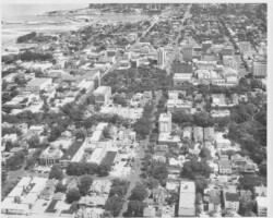
Aerial view of downtown business district looking south down 4th St. Both Willams Park and Maas Bros. are visible in the center of the frame, and First Presbyterian Church can be seen in the lowerleft at the corner of 4th Ave. N. and 3rd St. Bayboro Power plant in distance. c. 1954
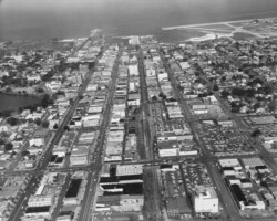
Aerial view, facing the waterfrnot, east along 2nd Ave. S. from about 10th St. Webb's City and Seaboard Coastline Depot in center foreground. c. 1950
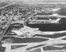
Aerial view of the Bayfront Center under construction. Land fill is complete, and the first steel beams are going up. c. 1963
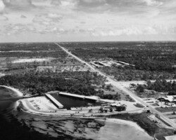
Aerial view of 34th St. S. O'Neill's Marina and Restaurant can be seen in the foreground, center. Frenchman's Creek and Johnstone's (later Huber's) Marina center. 62nd Ave. S. runs east from 34th St. between the two marinas. Doctor's Motel is at lower right. c. 1956
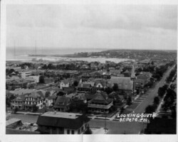
Elevated view looking southeast at 4th St. and 2nd Ave. S. St. Mary's Church at center right. Probably taken from a building on 1st Ave. S. c. 1920
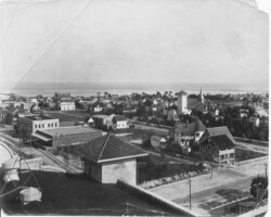
Elevated view, looking southwest from the roof of the La Plaza Theater in 1914. In the foreground is the corner of 1st Ave. S. and 5th St. Sibley's (Tomlinson's) tower at 2nd Ave S and 4th St, and St. Mary's Catholic Church is seen at right.
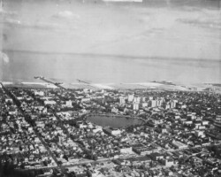
Aerial view looking southeast over downtown, with Mirror Lake in the center. Million Dollar Pier is visible on the left, and the Railroad pier is in the center. Albert Whitted airport is to the right. c. 1930
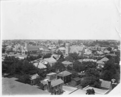
Elevated view looking northwest from about 2nd Ave. N. and 3rd St. Trinity Lutheran is in the center of the frame, and the newly built Coliseum is at left-center. The Lawn Bowling Club is also at left-center. c. 1925
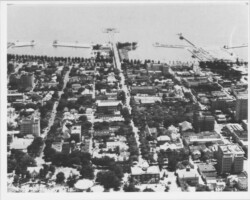
Aerial view looking east along 2nd Ave. N., with the Million Dollar Pier in the background. St. Petersburg Junior College can be seen at 2nd Ave. N. and 5th St. in the foreground, center. The Grammar school and the Suwanee Hotel are lower-right. c. 1940
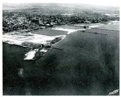
Aerial view of St Petersburg waterfront, August 14, 1933. From Vinoy Hotel to Bayboro and Whitted airport.
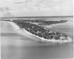
Aerial view of Pass-a-Grille looking north. Pass-a-Grille Beach Hotel & Casino can be seen on the beach, center left. Don CeSar Hotel is in the top left. Smoke from a large fire is in distance. c. 1940
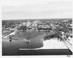
Aerial view of downtown looking west on Central Ave from Tampa Bay. The Central Yacht basin is in the center, with new fill extending the land on the south side of the pier approach, as well as north breakwater. The Spa building, Comfort Station No. 1 (Little St. Mary's), and the Senior Center can be seen on the on south side of the pier approach to the left, and Demens Landing Park can be seen to the right. c. 1950
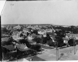
Looking northeast over Central Ave and 5th Ave N. First Avenue Methodist Episcopal Church, on the northeastern corner of 1st Ave N and 5th St. was built in 1913. School buildings seen to the left. and St. Peters Episcopal can be seen beyond. First Presbyterian Church dome is in the background center.


